

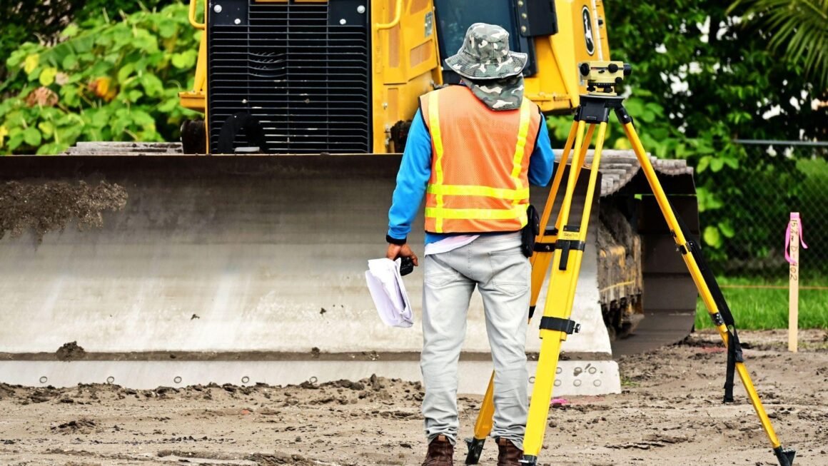
Excavating on a residential or commercial site without verified subsurface plans is one of the fastest ways to trigger expensive project delays or dangerous service disruptions. Conducting a thorough CCTV drain survey alongside electromagnetic pipe and cable locating ensures you accurately identify hidden stormwater lines, power conduits, and water mains before a single shovel hits the dirt.
Whether you’re a homeowner planning a rear extension, a plumber trenching a new drainage line, or a builder pouring a concrete slab, knowing what lies beneath your feet is critical.
What Hides Under Melbourne Soil
When working on residential or commercial sites across Melbourne, relying solely on old property diagrams or historical plans can lead to major trouble. Dial Before You Dig plans provide a general guide for mains utilities out on the street, but they rarely show the exact location of private service lines inside your property boundaries. Official council records often lack details about private line additions, modifications made by past owners, or temporary connections added years ago.
Subsurface networks can be surprisingly complex. Older properties in Melbourne often feature unrecorded terracotta sewer lines, galvanised water pipes, or direct-buried power cables running through unexpected parts of the yard. On top of that, natural ground movement, soil expansion, and past landscaping over time shift pipes away from where they were originally laid.
In modern builds, utility paths are tightly packed. Electrical conduits, telecommunication lines, gas pipes, and water connections often share narrow corridors along boundary walls or beneath driveways. Striking any of these while excavating post holes, digging footings, or trenching for new plumbing can derail your project instantly.
The Real Cost of Hitting an Underground Line
Accidentally striking a buried service carries high risks that go well beyond the immediate mess on site. Safety is always the primary concern for everyone on the tools. Direct contact with a live electrical conduit or a gas main puts earthmoving operators and site workers at serious risk of harm.
Project schedules suffer immensely from an unexpected strike. When a main water pipe or communication lead is cut, all site work stops immediately. Machinery sits idle while emergency repair teams are called out to isolate and patch the damage. The standby costs for sub-contractors and hired equipment add up fast, eating through your project contingency budget in a matter of hours.
There is also the structural integrity of your future build to consider. If a hidden stormwater pipe or sewer line under a proposed slab site is crushed during early site preparation, water can slowly pool under the new foundation without anyone noticing. Over time, that hidden water leak weakens the subgrade soil, leading to slab movement, uneven settling, and long-term structural issues that are painful to rectify once concrete is poured.
Combining Camera Surveys with Line Locating
How do you get a clear view of what is underground without digging up the whole site first? The secret lies in pairing internal pipe inspection with precise surface locating equipment.
A camera survey gives you a clear internal look at the state of your drainage network, revealing internal cracks, root intrusion, and structural sags. However, looking inside the pipe only tells half the story. You also need to know its exact physical path, direction, and depth from the surface before machinery starts digging.
This is where specialised line locate technology steps in to fill the gaps. Using radio frequency transmitters, electromagnetic receivers, and ground-penetrating radar, technicians trace both metallic cables and non-conductive pipes from above ground. A transmitter induces a detectable signal onto buried pipes, trace wires, or camera sondes, allowing the locator to track the exact path and depth of each service line.
Technicians mark these paths directly on the ground using colour-coded surface paint. This creates an easy-to-read, visual map right on your soil or concrete, showing your excavation team exactly where it is safe to work and where they need to hand-dig with care.
Navigating Private Utility Networks with Confidence
Many property owners are surprised to learn that public utility plans only cover the assets owned by service providers up to the meter or main junction. Everything past that point is considered a private utility, and keeping track of those lines falls squarely on the property owner.
Private utilities include the power lines running from your main switchboard out to a shed, external garden lighting conduits, secondary water feeds to granny flats, and internal stormwater networks. Because these private lines were installed after the main site was developed, they are rarely recorded on official council maps.
Having a professional technician map out both public connections and private service branches gives you a complete picture of your subsurface landscape. This level of clarity allows designers and architects to adjust footing positions or plumbing paths during the planning stage, long before earthmoving equipment arrives on site.
Protecting Your Site Before You Build
Subsurface utility mapping should never be an afterthought or something you schedule only after striking a pipe. Making thorough utility location a standard step in your initial site preparation protects your workers, keeps your construction timeline on track, and safeguards your overall building budget.
Before bringing heavy machinery onto a job site or driving timber posts into the ground, take the time to map out every buried asset. By identifying hidden pipes and electrical runs early, you can plan around them safely and ensure your construction project moves smoothly from slab to subsurface without any unwelcome surprises.